| | |  News Around the Republic of Mexico | October 2008 News Around the Republic of Mexico | October 2008 
Tropical Storm Marco Hits Mexico's Gulf Coast
 Miguel Angel Hernandez - Associated Press Miguel Angel Hernandez - Associated Press
go to original
Veracruz, Mexico - Tropical Storm Marco roared ashore on Mexico's Gulf coast with near-hurricane force winds on Tuesday, prompting a shutdown of some oil platforms and forcing the evacuation of some 3,000 people.
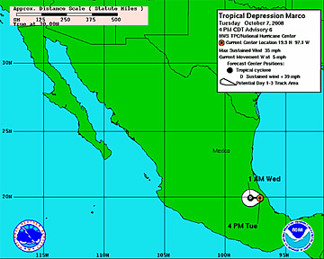
Once over land, Marco quickly weakened to a tropical depression and was expected to dissipate as it moved over Mexico's mountainous terrain. Forecasters still warned that rains of up to 5 inches could unleash mudslides.
The storm flooded coastal highways and brought heavy rains to the coast, including the city of Veracruz. But the busy port appeared to have escaped most of the storm's wrath.
The storm also appeared to have spared water-logged southern Veracruz state, where rain-swollen rivers jumped their banks, leaving the towns of Minatitlan and Hidalgotitlan under 10 feet (3 meters) of water last week.
Veracruz state authorities closed schools and set up some 200 shelters, while soldiers and rescue officials bused people from low-lying communities.
Mexico's state oil company said it had evacuated 33 workers from four offshore platforms in the Gulf of Mexico, closed six wells and shut down a natural gas processing plant in Veracruz state ahead of Marco's arrival.
Mexico's Communications and Transportation Department also ordered the small ports of Nautla and Alvarado closed to small vessels.
The storm hit land about 55 miles (90 kilometers) north of Veracruz with winds near hurricane strength. It was a tightly wound cyclone, with tropical-storm-force winds extending only about 15 miles (30 kilometers) from the center, according to the U.S. National Hurricane Center in Miami.
Meanwhile, on the other side of Mexico, Norbert strengthened into a Category 1 hurricane over the Pacific Ocean late Monday and forecasters said it could hit the southern Baja California Peninsula by the weekend before bringing rain to the northern Mexican mainland.
The hurricane center said Norbert was centered 545 miles (875 kilometers) south-southeast of the tip of the peninsula early Tuesday and it was moving west-northwest at 9 mph (15 kph). It had maximum sustained winds of near 85 mph (140 kph) and was likely to strengthen |
|
| |