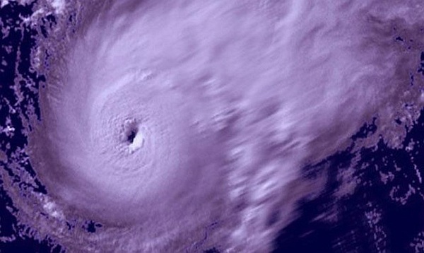
UPDATE: As of 5 pm PDT Friday, Bud has weakened to a tropical storm. Continued weakening is expected during the next 48 hours, but the tropical storm watch remains in effect for the coast of Mexico north of Cabo Corrientes to San Blas.
Hurricane Bud Now a Category 3 Storm
Puerto Vallarta, Mexico - The Mexican government has issued a hurricane warning for part of its western coast due to a powerful storm that could get even stronger in the coming hours, the National Hurricane Center said.
Hurricane Bud strengthened into a major storm Thursday night as it churned toward an area of beach resorts and small mountain villages on the Pacific coast stretching south from Puerto Vallarta. Authorities already have canceled school in low-lying communities and began preparing emergency shelters.
The Miami-based weather agency reported Thursday that Hurricane Bud had grown to become a Category 3 storm. The latest advisory indicated that the hurricane continues to pack sustained winds of around 115 mph.
"Slight strengthening is possible early Friday morning, and Bud could become a major hurricane before weakening begins by Friday afternoon," the center said. "Bud is still expected to reach the coast of Mexico as a hurricane."
Hurricane warnings have been issued for Manzanillo northwest to Cabo Corrientes, where winds are expected to exceed 39 mph in the coming hours. Eventually wind speeds may top 74 mph there, according to the hurricane center.
There are hurricane and tropical storm watches and warnings in effect for larger swaths of the country, including San Blas and Punta San Telmo as well.
As of Thursday evening, the system's center was located about 170 miles south-southwest of Manzanillo and 260 miles south of Cabo Corrientes. It was moving northeast at a rate of about 9 mph.
Whereas early reports had the storm turning offshore, the latest advisory from the hurricane center has Bud moving over the Latin American nation's mainland; "crossing somewhere along the warning area on the Mexican coast late Friday afternoon."
Thursday night, meanwhile, the winds should already be strong - in excess of 39 mph - "making outside preparations difficult or dangerous. Preparations to protect life and property should be rushed to completion," said the center.
The hurricane center also cautioned that, "Bud is expected to bring 4-6 inches of rain along the southwestern coast, with isolated amounts of up to 10 inches possible. These rainfall amounts could produce life-threatening flash floods and mudslides."
The government of Jalisco state prepared hundreds of cots and dozens of heavy vehicles like bulldozers that could be needed to move debris.
Swells generated by Bud had already begun to affect some coastal areas on Mexico's southern and southwestern coasts Thursday, and "are likely to cause life-threatening surf and rip current conditions," reported the hurricane center.
Officials in Puerto Vallarta said they were in close contact with managers of the hundreds of hotels in the city in case tourists needed to move to eight emergency shelters. It said the sea along the city's famous beachfront was calm, but swimming had been temporarily banned as a precaution.
Bud is the second named tropical storm of the East Pacific hurricane season.
UPDATE: According to NOAA, as of 2 pm PDT Friday, Bud has diminished to a Category One hurricane. Although continued weakening is forecast today, a tropical storm watch remains in effect for the coast of Mexico north of Cabo Corrientes to San Blas.
Update: 5:00 AM PDT on Friday, May 25, 2012, Bud, a Category 2 hurricane with winds of 110 miles (175 kilometers) per hour, weakened slightly overnight from its peak as a major Category 3 storm status on the five-step Saffir-Simpson scale. While Bud’s winds peaked at 115 mph overnight, it may still be a Category 2 storm when it goes ashore in Mexico later today between Manzanillo and Puerto Vallarta. It is then expected to reverse course, weaken and drift back out to sea tomorrow, dropping as much as 15 inches of rain in some areas.


