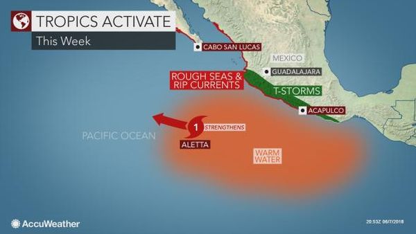
The first hurricane of the 2018 East Pacific hurricane season developed south of Mexico on Thursday. Aletta began as a tropical depression south of Mexico on Tuesday night before quickly reaching tropical storm status early Wednesday morning. The tropical system continued to strengthen, turning into a hurricane early Thursday afternoon.
The hurricane will track west-northwest well south of the Mexico coastline into the weekend. The forecast track of Aletta will keep the worst conditions well offshore, limiting the potential for any impacts to land.
Damaging winds and widespread flash flooding are not expected; however, more widespread showers and thunderstorms will occur from Oaxaca to Jalisco through Friday.
Some localized events of flash flooding are possible, but most locations will notice only an uptick in rainfall. Rough seas and dangerous rip currents will threaten beaches from Acapulco to Mazatlan as well as southern Baja California.
Boaters and bathers should use extreme caution and heed all small craft and beach advisories as they are issued. If caught in a rip current, it is best to swim parallel to shore until free of its influence.
A second tropical threat is expected to develop south of southern Mexico this weekend or early next week. There will be a higher risk for direct impacts from this potential tropical system as it tracks closer to the Mexico coastline.
AccuWeather meteorologists anticipate that the East Pacific basin will remain active this season with an above-normal number of tropical cyclones forecast.
Original article


