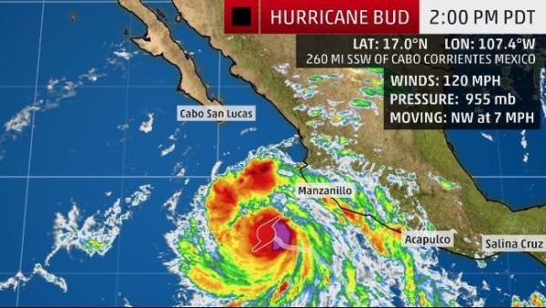
June 13 Update: Although Hurricane Bud was downgraded to Category 1 status on Tuesday evening and will continue to weaken, it will threaten western Mexico with heavy rainfall and potential flooding this week.
On the heels of Aletta, the first hurricane of the East Pacific hurricane season, Hurricane Bud, now swirling off the west coast of Mexico as a Category 4 storm, is forecast to bring heavy rain to Mexico over the next few days.
As of 5:45 am ET Tuesday, Bud had winds of 130 mph and was moving to the northwest at 7 mph. It was located about 450 miles south-southeast of the southern tip of the Baja peninsula in Mexico, the National Hurricane Center said.
Bud is expected to continue moving northwestward into Wednesday as it weakens, tracking closer to the Mexico coastline than Aletta. Coastal areas from Jalisco to Guerrero could have additional bouts of heavy rain and thunderstorms as Bud nears the coast during the middle of the week.
A tropical storm watch remains in effect for portions of Mexico's west coast from Manzanillo to Cabo Corrientes. Swells from Bud "are likely to cause life-threatening surf and rip current conditions" along the west coast of Mexico, according to the hurricane center.
In addition, rain from Bud "could cause life-threatening flash floods and mud slides in higher terrain." Rainfall amounts of 4-8 inches are expected with local amounts up to 12 inches through Wednesday, AccuWeather said.
Bud is the second hurricane of the eastern Pacific hurricane season, following Aletta, which is rapidly weakening far out in the open ocean. This is unusually early for two hurricanes to have formed, as the average date for the second hurricane to form in the eastern Pacific is July 14, Colorado State University meteorologist Phil Klotzbach said.
The eastern Pacific hurricane season is forecast to be quite active, thanks in part to a developing El Niño. NOAA predicts that seven to 12 hurricanes will form.
Sources: Accuweather.com • USA Today


