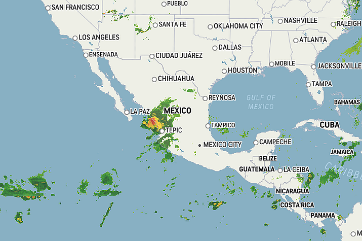
Puerto Vallarta, Mexico – Hurricane Orlene, this season’s ninth eastern Pacific hurricane, formed last Saturday morning, and though it passed Puerto Vallarta by as a Cat 3 hurricane on Sunday, forecasters say that the now Cat 2 storm is projected to reach the coast of mainland Mexico Monday or Monday night, making landfall just south of Mazatlán, Sinaloa.
Early Sunday morning, Orlene rapidly strengthened to a Category 4 hurricane on the Saffir-Simpson Hurricane Wind Scale. The hurricane remained at this ferocious strength for a time before encountering an environment hostile to tropical development and weakening to a Category 3 on Sunday afternoon.
On Sunday night, Orlene lost some strength after roaring over the Islas Maria, a former prison colony being developed as a tourist draw. The main island is sparsely populated, mainly by government employees, and most buildings there are made of brick or concrete.
As of Monday morning, Orlene was a Category 2 hurricane with sustained winds of 100 mph (155 km/h). Orlene is a rather compact storm, with hurricane-force winds reaching 15 miles (30 km) outward from its center and tropical-storm-force winds reaching 90 miles (150 km).
Orlene is projected to reach the coast of mainland Mexico Monday or Monday night, making landfall just south of Mazatlán, Sinaloa, where life-threatening flash flooding is a concern, according to Mexico’s CONAGUA Agency.
A hurricane warning is in effect for the coast of mainland Mexico from San Blas to Mazatlán. A hurricane watch is in effect for the coast of mainland Mexico from Playa Perula to San Blas and from Mazatlán to Bahia Tempehuaya, including the city of Puerto Vallarta.
A tropical storm warning is in effect for the coast of mainland Mexico from Playa Perula to San Blas. A tropical storm watch is in effect for the coast of mainland Mexico from Manzanillo to Playa Perula. Residents in the hurricane’s path are being advised to take extreme precautions due to the potential for life-threatening flooding, winds and dangerous rip currents.
The precipitation generated by this system could increase the level of rivers and streams, and cause overflows and floods in areas of the aforementioned states, for which the population and maritime navigation are urged to heed the warnings of the National Meteorological Service (SMN), of the National Water Commission (Conagua), and follow the indications of the state, municipal and Civil Protection authorities.
For more information on weather conditions, consult gob.mx/conagua, smn.conagua.gob.mx, nhc.noaa.gov, the @conagua_mx and @conagua_clima Twitter accounts, and on Facebook, as well as in the application for mobile devices ConaguaClima, where you can find out the forecast by municipality.


